5447 U.s. 80 Pearl, MS 39208
Other
MLS #: 4163519
Courtesy Of The Overby Company
Property InformationDescription
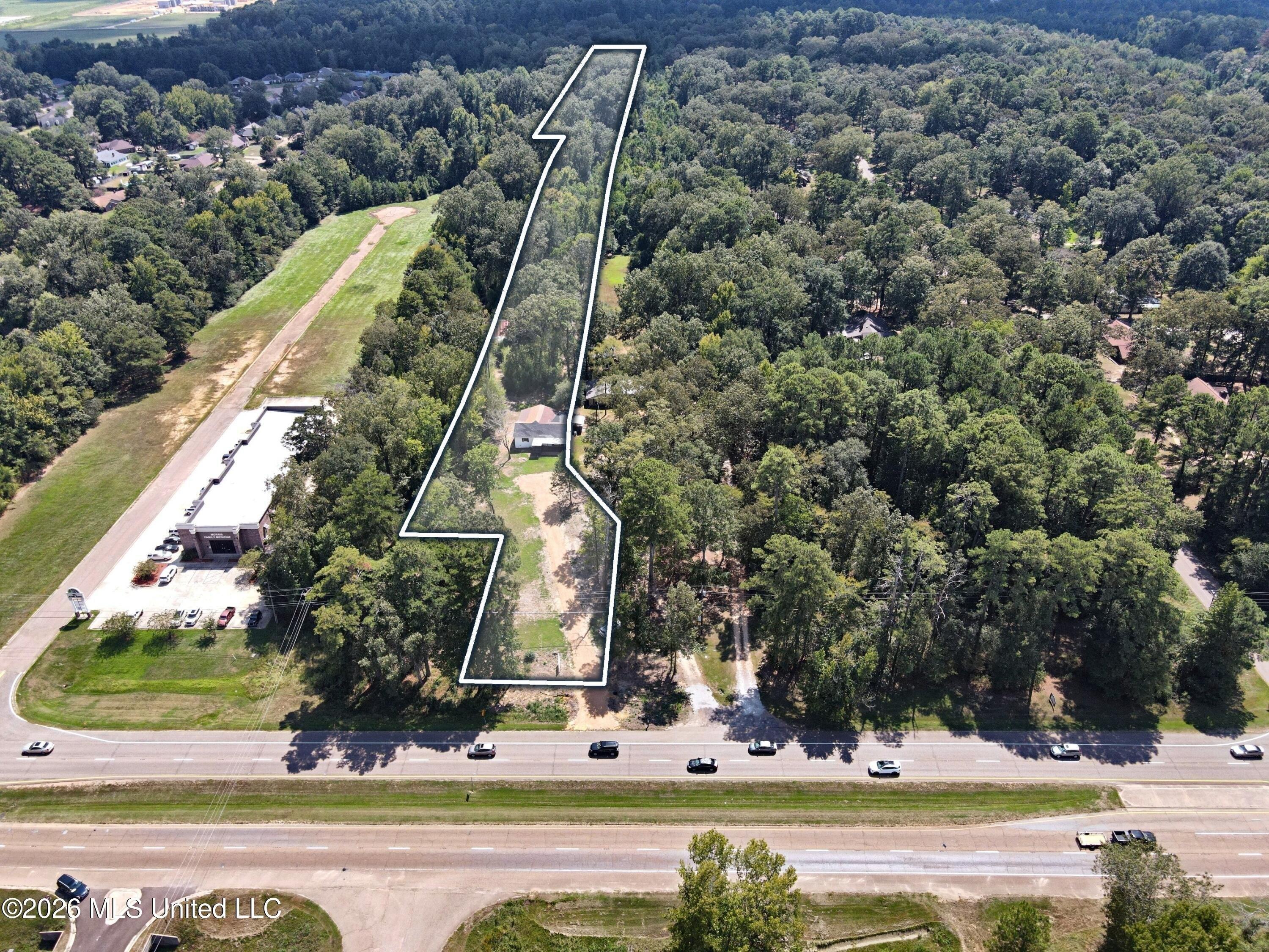
+/-9.13 acres of C-2 commercial land on US 80 within the Pearl city limits. The deep tract runs about 2,650 FT from US 80 back toward I-20, with Flood Zone X at the front (+/-3.1 AC) and rear (+/-2.6 AC) and a Zone AE band, including floodway, between them. The 2026 Future Land Use designation is Low Intensity Commercial, with C-2 zoning to the east. An updated 1949 residence (+/-1,840 SF, 4 BR, 1 full and 1 half bath) conveys with the land. Potential outdoor advertising upside, subject to City of Pearl approval. Priced at $425,000 ($46,550/AC, $1.07/SF). Acreage and boundary are approximate; buyer to verify by survey.
Features
- Legal Description: APPROX 9.13 AC E SIDE NW4 DB 125 PG 215 0022982 DB WB12 PG 0471 0042784 DB 540 PG 0055-0000 0092287
- MLSID: 4163519
MAP & DIRECTIONS
Copyright © 2026 MLS United. All rights reserved. All information provided by the listing agent/broker is deemed reliable but is not guaranteed and should be independently verified. Information being provided is for consumers' personal, non-commercial use and may not be used for any purpose other than to identify prospective properties consumers may be interested in purchasing.